IMMERSE YOURSELF IN THE ANDES A trip to the past
- Information
- Tour Plan
- Gallery
- Additional Info
- Similar Tours
What's included
- A guided tour of important places
- Transportation
- Meals, unless expressly states

Quilotoa Lake hidden in a ecological reserve!
Quilotoa Crater lake belongs to the Ilinizas Ecological reserve, located on the northwest of the Cotopaxi province. Its a nicely hidden place of the Ecuadorian Andes, holding a beautiful lake whose water goes from dark blue to emerald green water, locals say it turns into seven different colors between dark blue to emerald green depending of its constant internal activity which expels different minerals. This crater lake always amazes with its beauty!
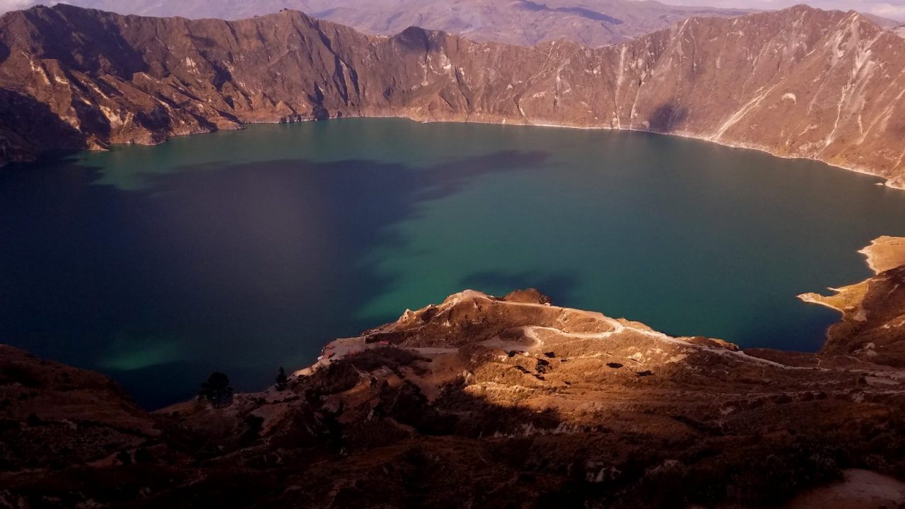

A peaceful caldera filled with water.
This Volcanic origin crater lake takes us back to the earths formation history of impresive geological changes, as deep canyons and high mountains, reminding us that everything is in constant transformation in nature. Geography does not cease to change and amaze us with its majesty and grandeur, remainings of volcanic ash are found in every inch of the Quilotoa area.
Chilly and peaceful with an unmeasurable beauty, Quilotoa crater lake is a huge caldera that holds a naturally formed impresive lake, as part of its volcanic activity centuries ago. Considered a dormant volcano but at the same time active, since from its center part is constantly sending out different minerals and bubbles come up to the surface, liberating pressure all the time.

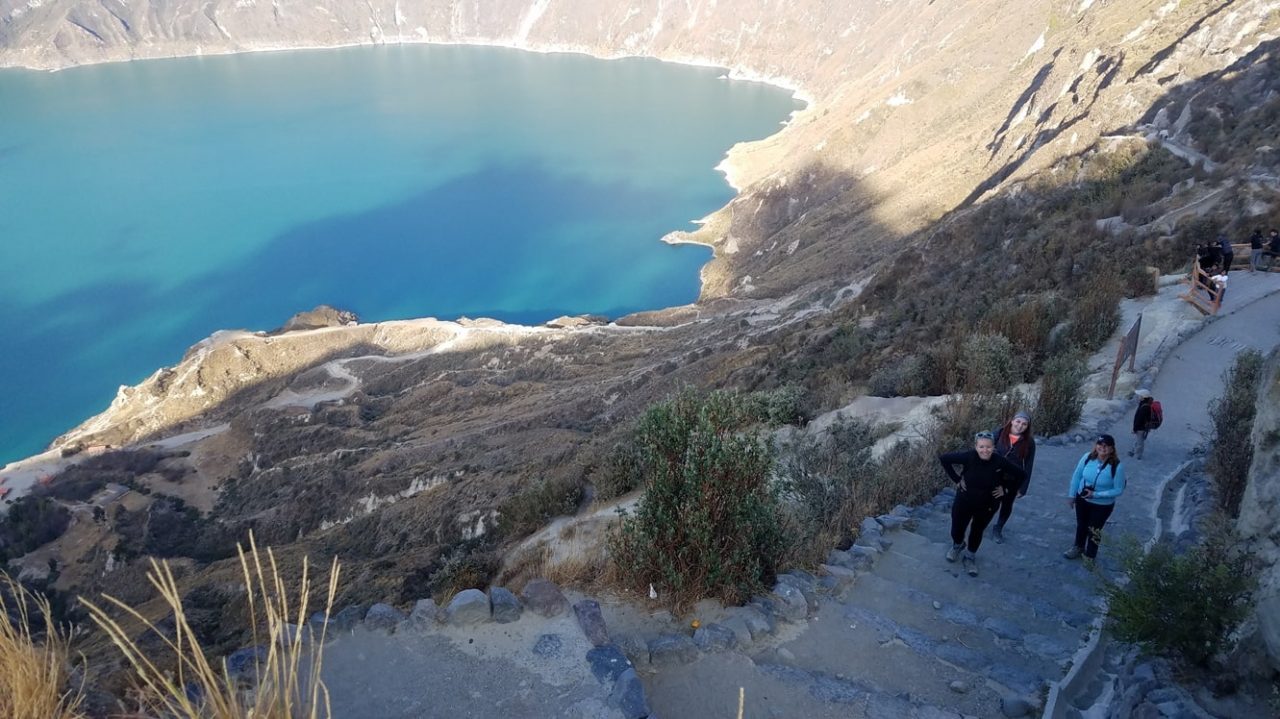
Smile you are at the Quilotoa Crater
Several studies show that the Quilotoa´s last eruption took place about 738 (1280 confirmed last eruption source: Smithsonian Institution) years ago, its ash flew all the way to the Pacific Ocean (250km), and to the east reached the east side area of the Cotopaxi National Park and part of the Ecuadorian Amazon.
Quilotoas ecosystem is called
Páramo: chilly, mainly a dwarft forest and several tall trees as pine trees the “Paramo is similar to an “Alpine tundra”
What is the weather like at the Quilotoa?
The weather in the Andes is constantly changing, if you pay close attention to the climate you will be able to tell and feel this changes approximately every twenty to thirty minutes and the Quilotoa is not an exception. Due to the Quilotoa´s high elevation 3900 m (12792 ft) it can be cold and feel chilly when windy, but also be very comfortable in a sunny day without wind.
It is very variable, so be prepared for sun and rain in the same day.
Quilotoa Maps


- Day 1
Quito & Quilotoa
Please remember all our tours are customizable.
You will start early morning for a drive to get out of the city, then, connect to the Panamerican Highway, heading south of Quito. This is a lovely drive since you will go across the place where mountains and volcanoes are one next to the other on top of a high plateu and are part of the Andes. (The Andes extend from north to south through seven South American countries: Venezuela, Colombia, Ecuador, Peru, Bolivia, Chile, and Argentina. S0urce:Wikipedia). So, depending if weather helps, you will be able to see the Andean mountain range as well as the endless farms, cows, llamas, sheeps and small towns along this drive.
After more or less, 1hour 45 minute drive you will get off the Panamerican highway to inmerse to the heart of the Andes, towards the west and head to the furthermost andean lagoon, Quilotoa!. Here, the most challenging part of this trip begins! A hike down into the Quilotoa, crater lake, is a 40 minute hike, and you have the option to go back up hiking or to go back up, on a mule ride!
As a second option, go for a one and a half hour hike to a close by comunity located on the craters rim called Shalalá, have a snack and hike back.
As a third pption go for a 4 hour hike around the rim, for this option this trip starts at 6 am.
*Two day tour options is to do a hike from Chucchilan to Quilotoa Lake or Viceversa, for this hike we need a two day tour, so please feel free to ask us about this avilable tour.
After the hoke you chose for a day trip, have lunch at a communitary restaurant to try a typical ecuadorian meal, and last visit the community market in search for the right handcrafts before returning to Quito.
More about this tour
Located north west of the Cotopaxi province is the Ecological reserve Ilinizas, were the Quilotoa crater lake is part of this Ecological reserve high in the Ecuadorin andes and well hidden in the mountains, its the westernmost andean area of Ecuador, due to its height above 3000 msnm this ecosystem is considered a "Paramo", wich is similar to an Alpine tundra.
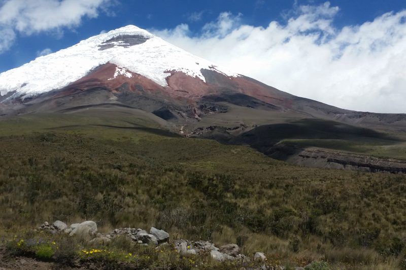
On a day trip to Quilotoa Crater Lake from Quito, while riding towards que south of the capital city you will ride along the Panamerican highway and along the "Avenue of the Volcanoes, this is the area of the andean mountain range that Alexander Von Humbolt (1802) called Avenue of the volcanoes, where one mountain is right afer the next one, without openings in between and are located on both sides of the Panamerican Highway. the drive on the Panamerican highway ends in Latacunga where you will start going up and towards the west side of Ecuador to enjoy breathtaking landscapes of the Ecuadorian Andes. Every turn is an amazing and unique landscape, uncovering a different sight along this trip.

